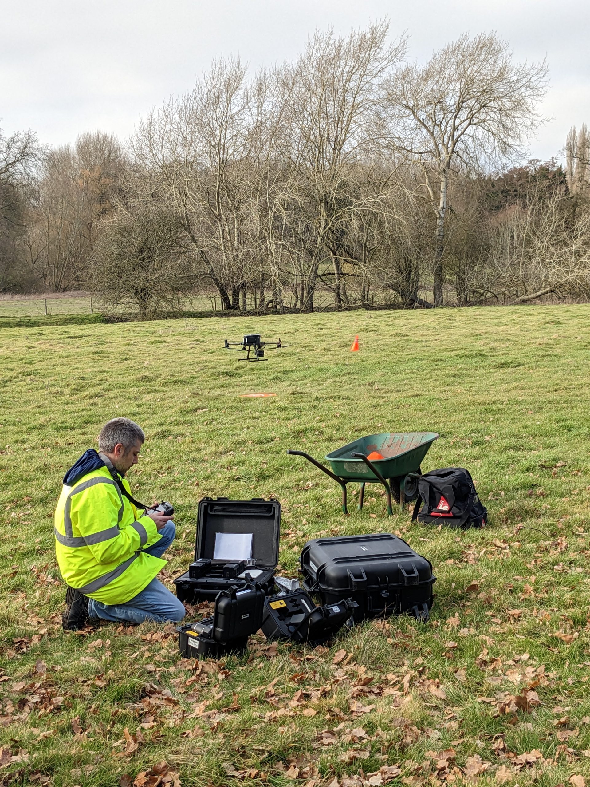
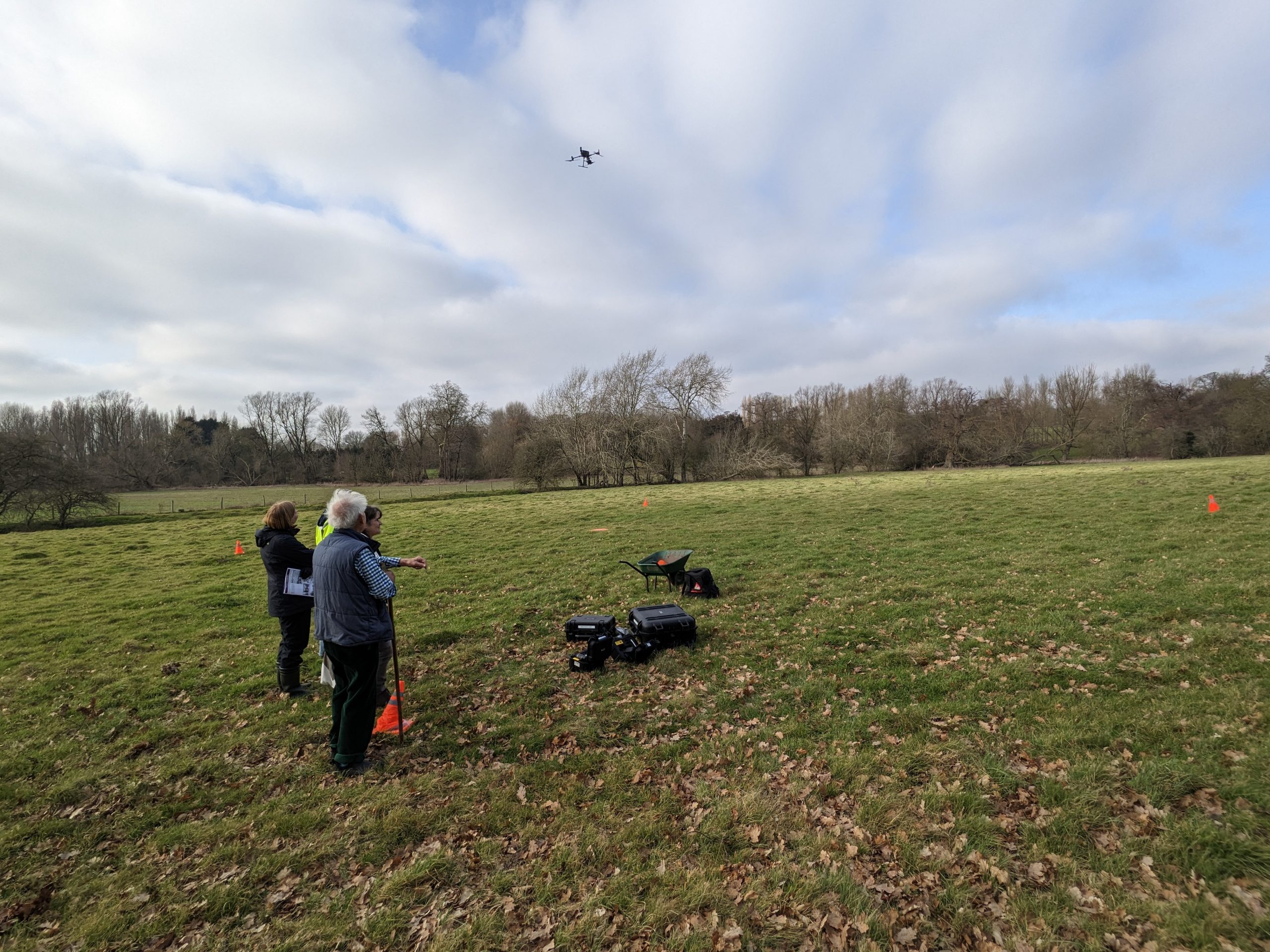
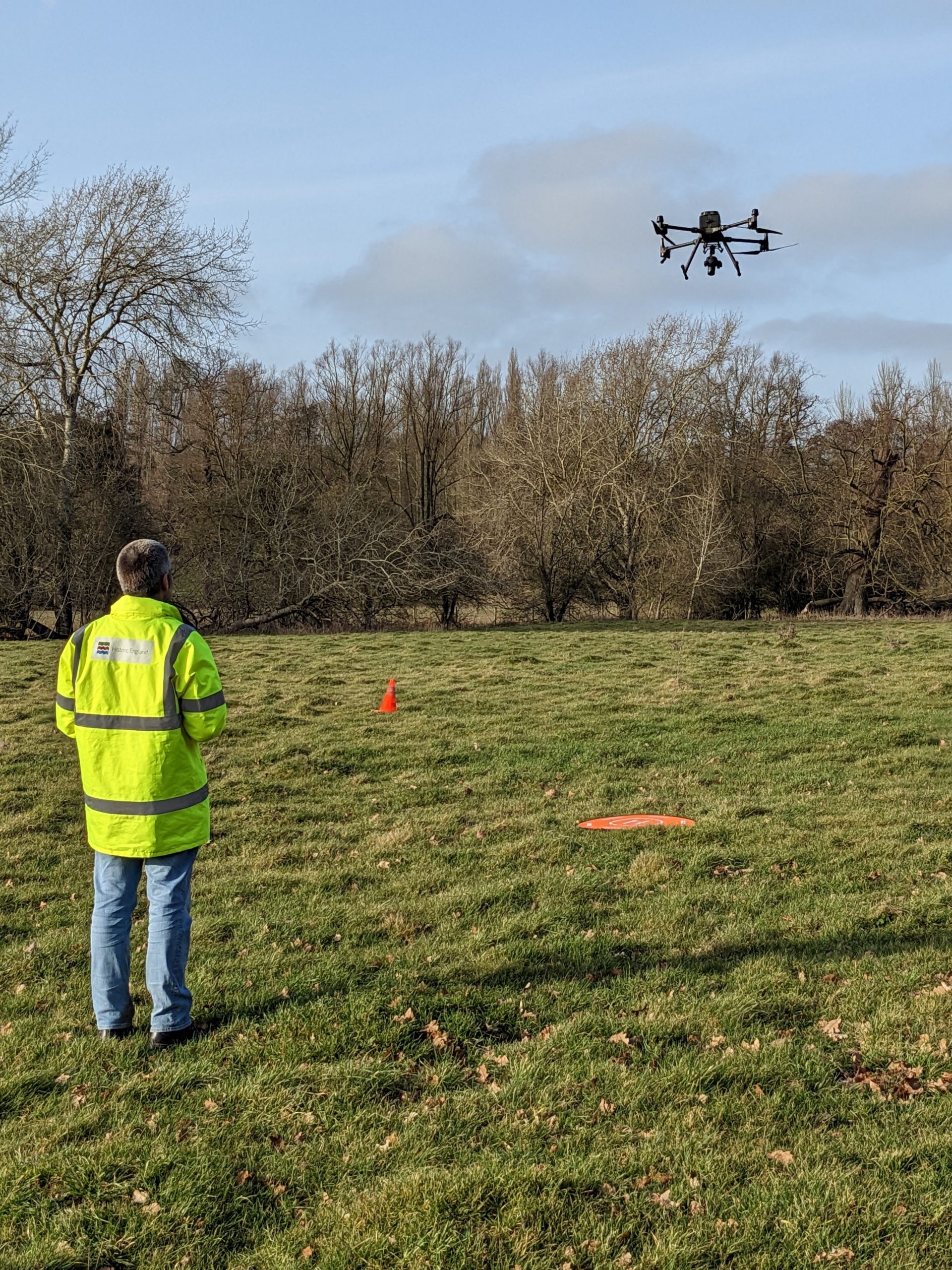
On 21st February we met with the Historic England survey team at the Old Church where they were conducting a landscape and archaeological survey.
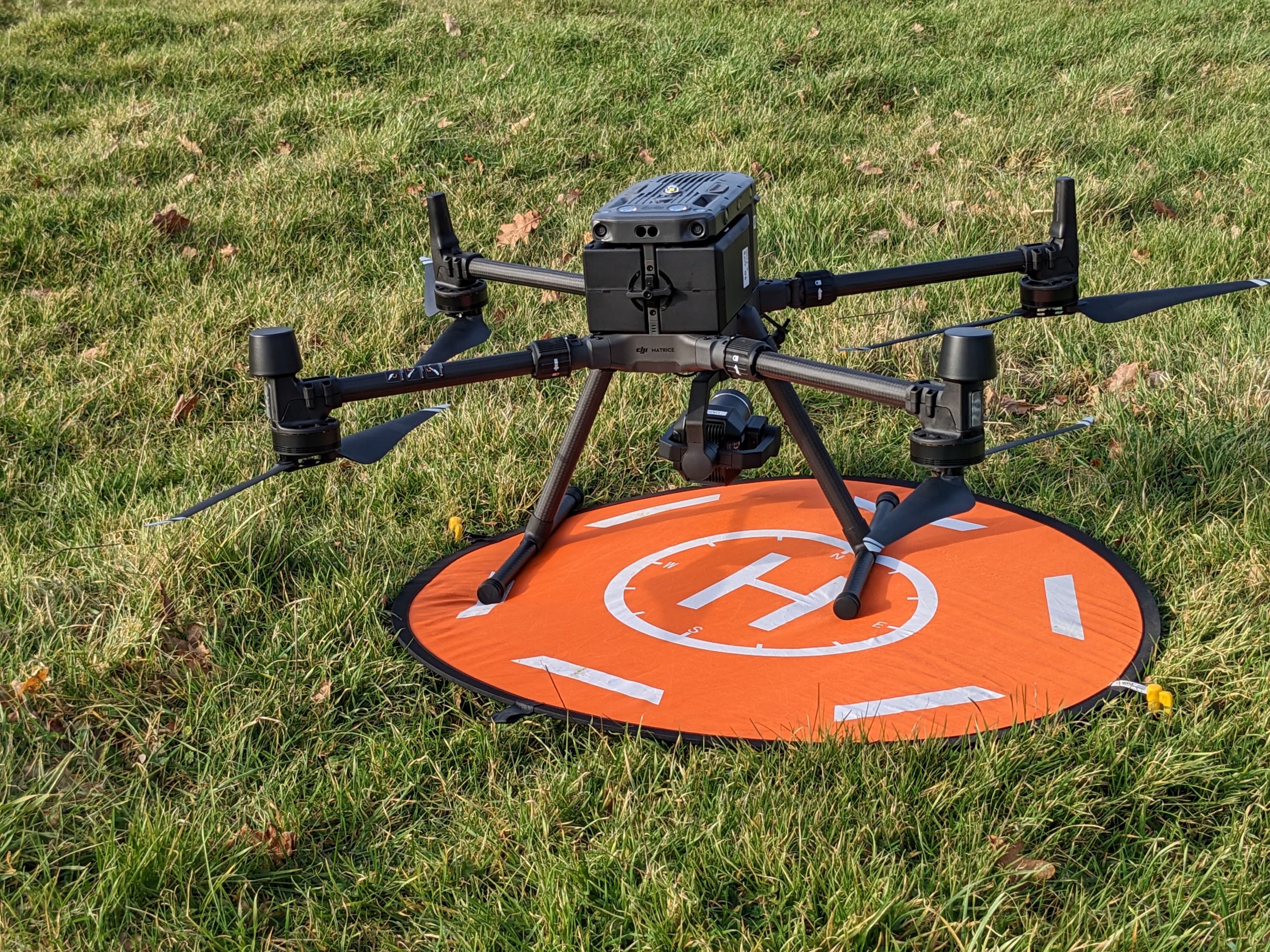
A new advanced drone, only a few months old was used. It is programmed to overfly the site automatically on a precalculated track, no matter the wind or weather, covering the area to be surveyed in overlapping ‘lanes’ taking images while carrying different swappable sensors.
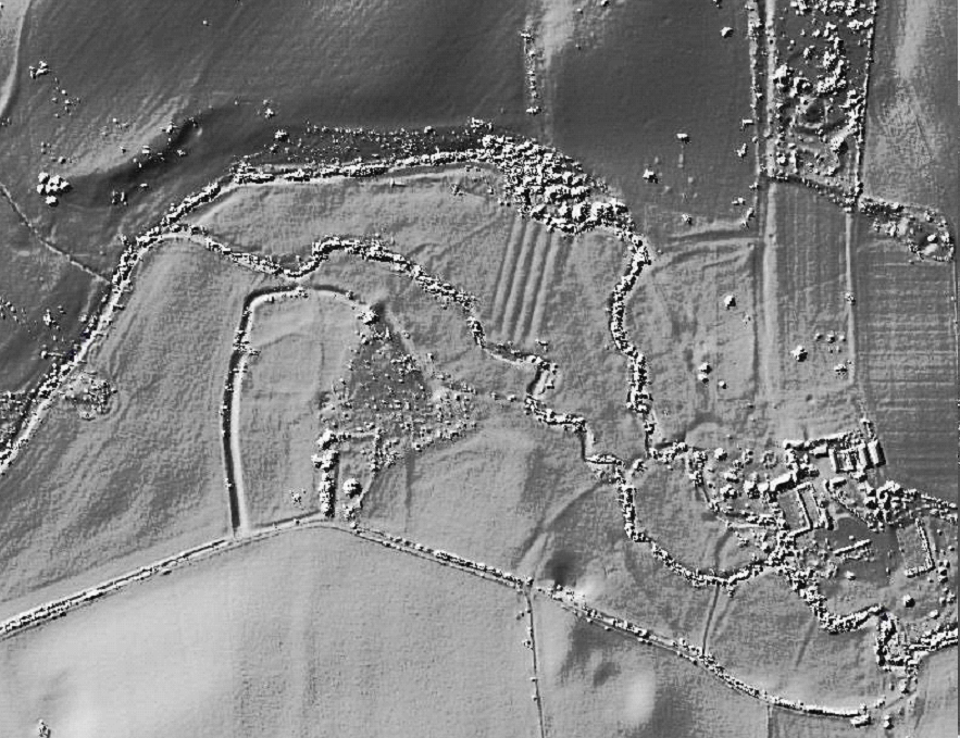
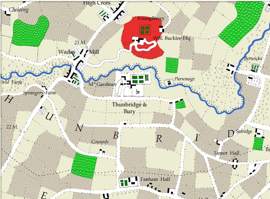
First it was equipped with a LIDAR sensor, which is a technology that sends out laser pulses to the ground and measures the time for the light to bounce back, giving extremely accurate measurements of distance to ground. The end result is a detailed black and white map enhancing and highlighting features on the ground like depressions, paths, trenches, ramparts and platforms that are often not visible to the naked eye, allowing further investigation and interpretation of the landscape. Much of the UK has been mapped by LIDAR from planes, including the Rib Valley shown in the image below, but this survey will be of far higher resolution and accuracy.
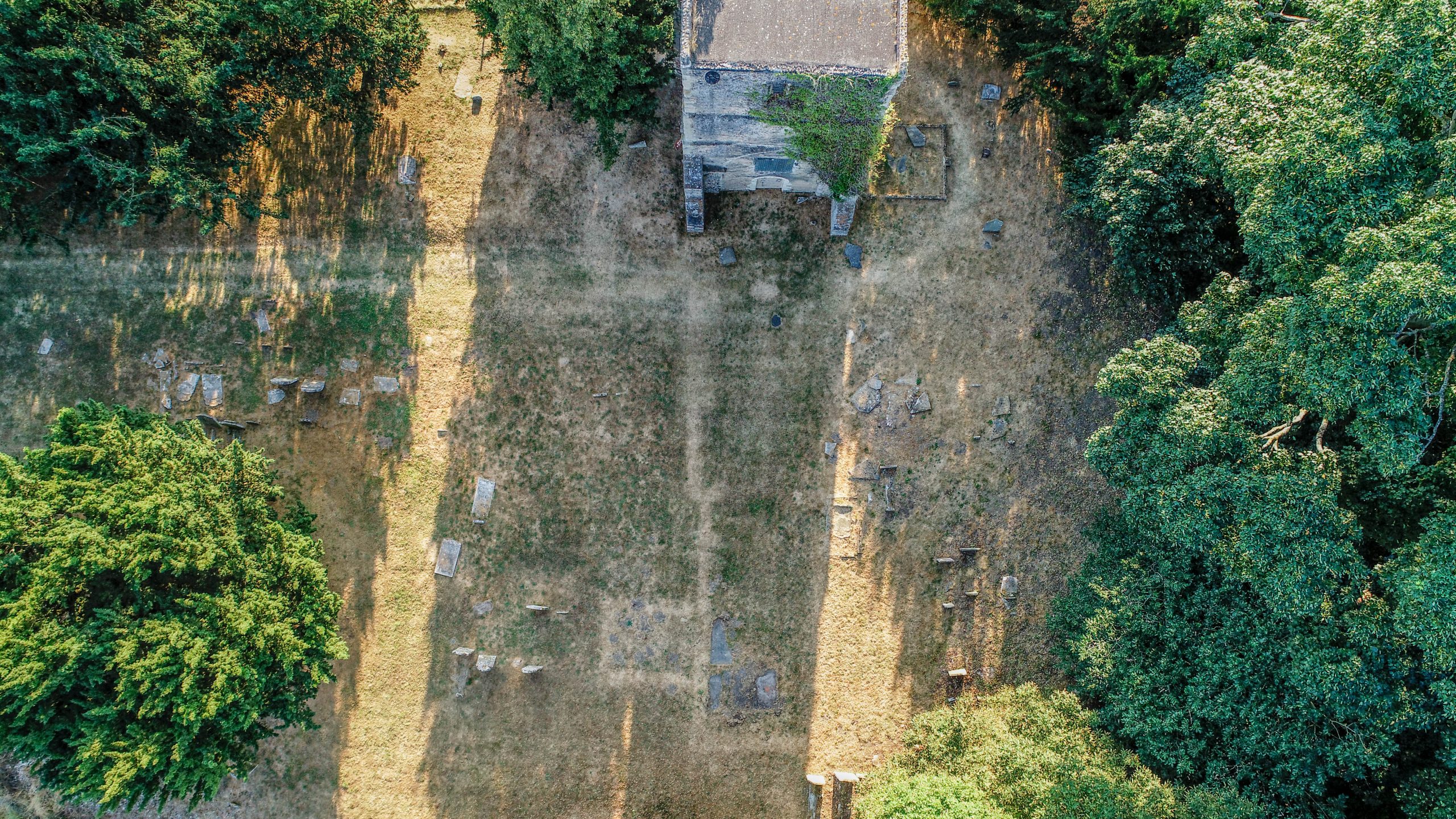
Next, the drone was fitted with a high resolution camera, which takes photographs at regular intervals in a wide field of view. With special software back in the office, these images are ‘stitched’ together to form a flat map of the site with extremely accurate GPS positioning. Other software will also be able to generate a 3D projected map that can be manipulated to show elevations and objects from any angle. We have supplied pictures of drought marks showing the foundations of the old church and it may be possible to overlay that onto the maps to highlight exactly where it extended. We hope to also be able to map specific graves audited in the 90’s to their real world locations, even those with no headstone now remaining.
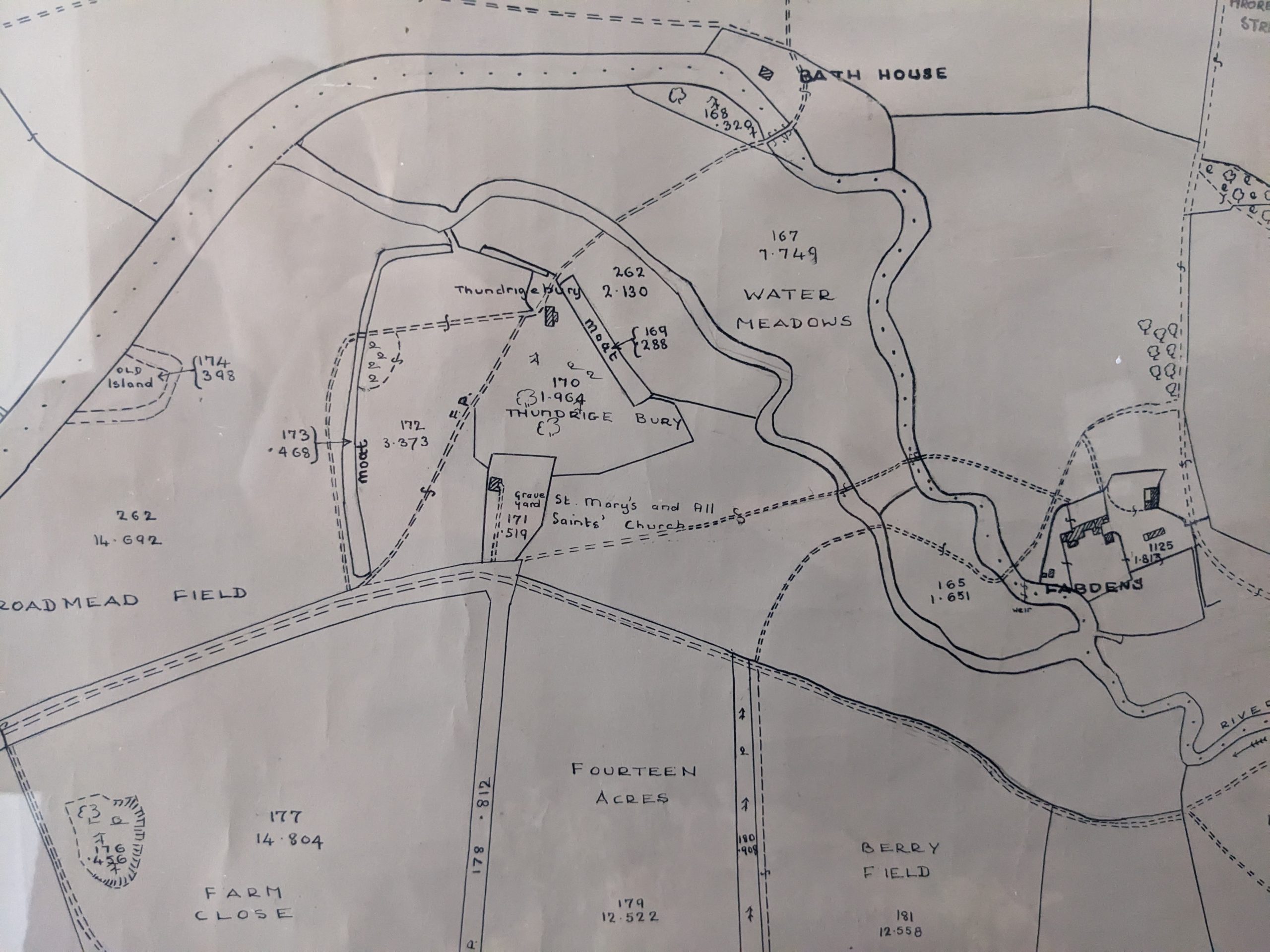
All of this information together will be interpreted by Historic England, with the help of old maps and records and their visual site inspection, to assess and report what was present on the site over time, what features may have been and their purpose. This may try and address questions such as why the moated enclosure is so unusually large; what might it have been used for (e.g. agriculture, livestock, rabbits, ornamental), why are there ditches only apparent on 2 sides, how is the large square moat connected to the river at the eastern end different to the rest of the moat, where was Thundridge Bury manor precisely on the ground and all its ancillary buildings like stables and vicarage.
It is possible this may warrant further investigation such as geophysical survey, but that is only speculative.
When we have any more news or results, we will of course publish them here. Later in spring it is planned to conduct a detailed photographic and measured survey of the inside and outside of the church tower and we will let you know when that happens.
Thanks are of course due to Historic England and the survey team for their time, expertise and support. It was a real pleasure and education to spend time with them both. Thanks also to the landowners for permission to access the moated enclosure and surrounding area.